Mar 06 2024
Published by
yl10038

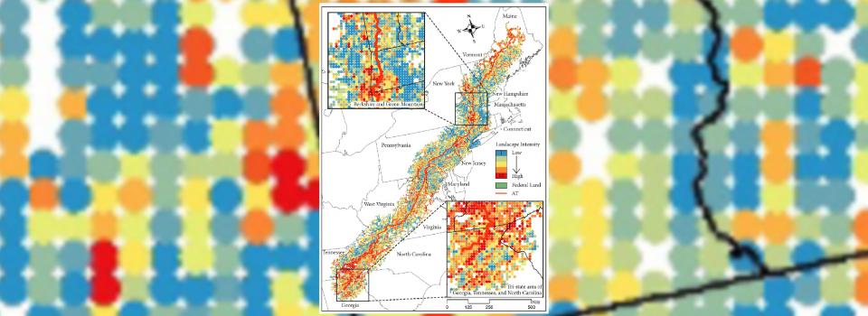
In a recent study led by Assistant Professor of Urban Science and Policy Guan Chenghe, published in Urban Forestry & Urban Greening, researchers explored landscape sensitivity within trails located in the wildland-urban interface (WUI).
They proposed a comprehensive landscape sensitivity index (CLSI) using multiple regression, cluster analysis, and correlation analysis. The study utilized the Appalachian Trail (AT) in the US as a case study, revealing significant landscape sensitivity areas influenced by rock formations, wetlands, and biodiversity. Additionally, the study suggested tailored conservation strategies for high sensitivity areas to balance wilderness protection and urban development priorities.
This paper is one of the key components of the Shanghai Key Laboratory of Urban Design and Urban Science (LOUD)’s research on green-blue space planning with AI-enhanced urban sensing techniques.
Read more about the publication:
Cite the paper:
Guan, C. *, You, M. (2024) Integrating landscape and urban development in a comprehensive landscape sensitivity index: A case study of the Appalachian Trail Region. Urban Forestry & Urban Greening 93, 128234. https://doi.org/10.
1016/j.ufug.2024.128234


